Iran is mostly a high, dry plateau enclosed by mountains: the Alborz in the north, the Zagros in the west and south-west, and lower ranges in the east. Inside that ring lie two of the world’s great deserts, the Dasht-e Kavir and the Dasht-e Lut, while the edges drop to two very different seas, the Caspian in the north and the Persian Gulf and Gulf of Oman in the south. This shape explains almost everything else about Iran, from where people live to how they farmed and built.
| Area | 1,648,195 km² (CIA World Factbook) |
|---|---|
| Highest point | Mount Damavand, about 5,610 m |
| Lowest point | Caspian Sea shore, about 28 m below sea level (and falling) |
| Main ranges | Alborz, Zagros, Kopet Dagh, eastern highlands |
| Largest deserts | Dasht-e Kavir (Great Salt Desert), Dasht-e Lut |
| Longest river | Karun, roughly 850 to 950 km depending on the source |
| Largest lake | Lake Urmia (salt lake, much reduced since the 1990s) |

The Iranian Plateau
Geographers use the term Iranian Plateau for the high land that runs from eastern Anatolia and the Caucasus to the Indus valley. Modern Iran covers its western and largest part. Most Iranian cities, including Tehran, Isfahan, Shiraz, Mashhad and Tabriz, stand between about 1,000 and 1,800 metres above sea level. That height makes winters on the plateau colder than visitors expect, and the thin, dry air gives the clear night skies the desert towns are known for.
The plateau was formed, and is still being shaped, by the slow collision of the Arabian plate with Eurasia. The same pressure that lifts the Zagros makes Iran one of the most earthquake-prone countries on Earth. The Rudbar earthquake of 1990 and the Bam earthquake of 2003 each killed tens of thousands of people; our history page on major earthquakes in modern Iran tells those stories.
The Alborz: a wall along the Caspian
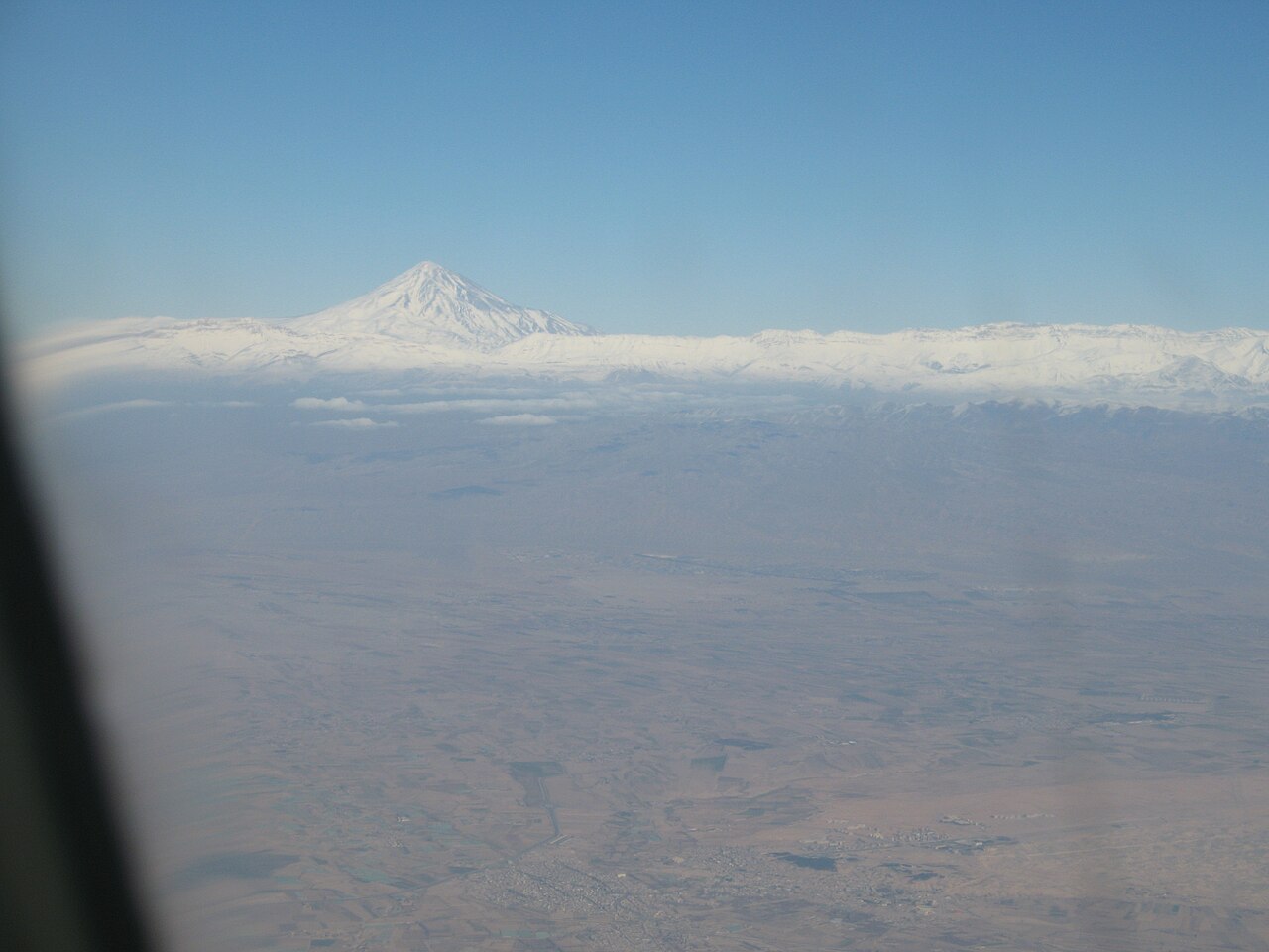
The Alborz (البرز) is a narrow, steep range that curves for several hundred kilometres along the southern shore of the Caspian. Its northern slopes catch moisture off the sea and are covered in dense broadleaf forest, the Hyrcanian forests, listed by UNESCO in 2019. Its southern slopes face the dry plateau, and Tehran sits at their foot. The highest peak in the range, and in the whole Middle East, is Damavand, a snow-capped dormant volcano that appears in the Shahnameh as the mountain where the tyrant Zahhak was chained. Our guide to Mount Damavand covers the climb. The second peak of the range, Alam-Kuh (about 4,850 m), is a favourite of Iranian climbers.
The Zagros: Iran’s backbone
The Zagros runs for about 1,500 kilometres from the borders of Turkey and Iraq to the Strait of Hormuz. It is not one ridge but a series of parallel folds, with long valleys between them. Its highest summits, such as Dena (over 4,400 m) and Zard Kuh, hold snow into summer, and their meltwater feeds the rivers of Khuzestan and the Isfahan oasis. For thousands of years the Zagros has been the summer pasture of nomadic and semi-nomadic peoples such as the Bakhtiari and Qashqai, who move their flocks between highland and lowland each year. The southern Zagros also holds most of Iran’s onshore oil fields.
Eastern highlands and the volcanoes
In the north-east, the Kopet Dagh forms the border with Turkmenistan, and the hills of Khorasan surround Mashhad. A chain of lower, broken ranges runs south along the eastern frontier towards Baluchestan. Iran has several large volcanoes besides Damavand: Sabalan (about 4,800 m) in Ardabil province, Sahand near Tabriz, and Taftan in Sistan and Baluchestan, which still releases gas from its summit vents.
The two great deserts
The Dasht-e Kavir (دشت کویر) in north-central Iran is a salt desert: a crust of salt and mud over marsh that is treacherous to cross. The word kavir itself means salt desert in Persian. Further south-east, the Dasht-e Lut is a desert of sand, gravel and wind-carved ridges called kaluts, some over 100 metres high. In 2005 NASA’s MODIS satellite instrument recorded a land surface temperature of 70.7°C in the Gandom Beryan area of the Lut, one of the highest ever measured (Mildrexler, Zhao and Running, 2011). This is the temperature of the ground, not of the air. UNESCO inscribed the Lut as a World Heritage Site in 2016. More on visiting it on our Dasht-e Lut page.
Seas, coasts and islands
Iran’s northern coast on the Caspian Sea, the world’s largest enclosed body of water, is short but heavily populated, with rice fields, tea gardens and resort towns. The Caspian’s level has been falling for years, leaving some harbours and beaches stranded. The southern coast, along the Persian Gulf and the Gulf of Oman, is long, hot and humid, with the ports of Bushehr, Bandar Abbas and Chabahar. Iran’s Persian Gulf islands include Qeshm, the largest island in the Persian Gulf, and Kish, Hormuz, Lavan and Kharg, the main oil export terminal. Iran also holds Abu Musa and the Greater and Lesser Tunbs, whose ownership the United Arab Emirates disputes.
Rivers, lakes and the problem of water
Iran has few large rivers. The Karun, which flows through Ahvaz to the Shatt al-Arab, carries the most water and is the only one navigable for any distance. Other important rivers are the Karkheh, the Sefid Rud, which cuts through the Alborz to the Caspian, the Aras on the northern border, and the Zayandeh Rud, which gave Isfahan its gardens and now often runs dry in the city. Most rivers on the plateau never reach the sea; they end in salt lakes or marshes such as the Gavkhuni wetland.
The largest lake, Lake Urmia in the north-west, lost most of its surface area between the 1990s and the 2010s because of dams, irrigation and drought, and its partial recovery has been uneven. The Hamun lakes on the Afghan border depend on the Helmand river and dry out in drought years. In 2025 Tehran’s reservoirs fell so low that President Pezeshkian said publicly that the capital might eventually have to be moved. To get water across the dry plateau, Iranians developed the qanat, an underground channel tapping groundwater at the foot of the hills; see our page on qanats.
For the green side of Iran, read the north of Iran (Shomal) and our page on the Hyrcanian forests; for how all this shapes the weather, continue to the climate of Iran.
Persian words from this page
| کوه | kuh | mountain |
| دشت | dasht | plain |
| کویر | kavir | salt desert |
| دریا | daryâ | sea |
| دریاچه | daryâche | lake |
| رود | rud | river |
| دماوند | Damâvand | Damavand |
Sources and further reading
- W. B. Fisher (ed.), The Cambridge History of Iran, Vol. 1: The Land of Iran (Cambridge, 1968).
- CIA, The World Factbook: Iran, Geography section.
- UNESCO World Heritage Centre, Lut Desert and Hyrcanian Forests.
- D. J. Mildrexler, M. Zhao and S. W. Running, “Satellite finds highest land skin temperatures on Earth”, Bulletin of the American Meteorological Society 92 (2011).
- Encyclopaedia Iranica, articles on Alborz, Zagros, Karun and Lake Urmia (iranicaonline.org).
Want to learn Persian? Get the free Starter Pack
Get the 14-page printable Starter Pack (all 32 letters, a 7-day reading plan, 100 core words and 20 survival phrases) and a short 5-email course. Free.
More in Iran Facts and Overview
- Iran at a Glance: Key Facts and Figures
- Geography of Iran: Mountains, Deserts and Seas
- Climate of Iran and the Best Time to Visit
- The 31 Provinces of Iran
- The People of Iran: Ethnic Groups
- Languages Spoken in Iran
- Religion in Iran Today
- How Iran Is Governed
- The Economy of Iran
- Iranian Currency: Rial and Toman Explained
- Persian Food: Dishes Every Visitor Should Try
- Iranian Festivals and Public Holidays
- Iranian Culture and Etiquette
- Iranian Handicrafts
- UNESCO World Heritage Sites in Iran
- Iran Records and Superlatives
- National Symbols of Iran
- Sports in Iran
- Practical Tips for Travelling to Iran