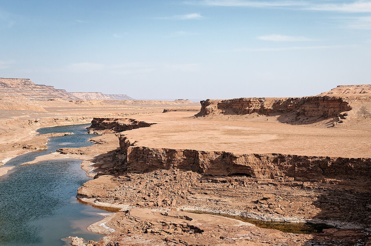
Dasht-e Lut, the Lut Desert, is a vast basin of sand, salt and wind-carved rock in south-east Iran, covering about 51,800 square kilometres between Kerman, Sistan and Baluchestan and South Khorasan. It is known for three things: its giant wind-sculpted ridges, some of the highest sand dunes in the world, and satellite measurements of the hottest land surface ever recorded. It became Iran’s first natural UNESCO World Heritage Site in 2016.
| Persian name | دشت لوت (Dasht-e Lut), “the bare plain” |
|---|---|
| Extent | Basin about 480 km long and 320 km wide; desert area about 51,800 km² |
| Provinces | Kerman, South Khorasan, Sistan and Baluchestan |
| Hottest surface measured | 70.7 °C (MODIS satellite, 2005); later analyses up to 80.8 °C |
| UNESCO | World Heritage List, 17 July 2016 |

Three landscapes in one desert
The name says it: lut means bare or empty, and dasht a plain. For most of the year almost nothing grows here. In the spring, water flows briefly from the mountains of Kerman into the basin and dries up, leaving rock, sand and salt. Inside that emptiness, the wind has made three very different landscapes.
The kaluts
In the west and centre, the wind has cut the soft sediments of an old lake bed into long parallel ridges and corridors, running for over 150 km. These are the kaluts, known to geologists as yardangs, the largest field of their kind on Earth. They are the part of the Lut that most visitors see, from the oasis town of Shahdad. Our page on the Kaluts of Shahdad covers them in detail.
The sand seas
In the south-east lies a great sand sea, with dunes that reach around 300 metres in height, among the tallest anywhere. This area is remote and rarely visited except by expeditions.
Salt, gravel and lava
In the east and north, much of the desert is a flat or gently rolling surface of salt pans, gravel and stones polished by wind. The lowest areas lie at about 110 m above sea level. In the north-west is Gandom Beryan, a dark plateau of volcanic rock whose name means “roasted wheat”. One study suggests that volcanic rocks cover more than half of the desert’s surface.
The hottest place on Earth?
The Lut’s fame as the hottest place on Earth rests on satellite data, not on thermometers in the shade. NASA’s Aqua satellite carries an instrument called MODIS that measures how hot the ground surface is. When researchers David Mildrexler, Maosheng Zhao and Steven Running looked at its readings from 2003 to 2010, the highest land surface temperature anywhere on the planet was in the Lut: 70.7 °C, recorded in 2005. They published the result in 2011. A later analysis of newer MODIS data reported a land surface temperature of about 80.8 °C in the Lut.
Two points matter when these numbers are quoted. First, they are temperatures of the ground surface, especially dark rock and stones, which get much hotter than the air. The air temperature at the time of the 70.7 °C reading could have been anywhere from about 30 to 54 °C. Second, there are no permanent weather stations inside the Lut, so its air temperatures are estimated from stations around the edge. The official world record for air temperature is a separate matter. What can be said with confidence is that the Lut has repeatedly produced the hottest land surface readings measured from space.
Rain is just as extreme in the other direction: the basin probably receives less than 30 mm a year.
People on the edges
Few people have ever lived inside the Lut, but its margins are rich in history. On the western edge, the Bronze Age town of Shahdad flourished in the third millennium BCE, linked to the Jiroft culture of Kerman. On the far eastern side, in Sistan, lies Shahr-e Sukhteh, the “Burnt City”, one of the largest Bronze Age sites of the Iranian plateau. Caravan routes crossed the desert’s edges between Kerman and Khorasan, and travellers feared them. Archaeological surveys along the western flank have found dozens of ancient sites from the fifth millennium BCE to the late Islamic period.
Visiting the Lut safely
- The usual gateway is Shahdad, reached from Kerman in about two hours, often after a stop in Mahan at Shazdeh Garden. Expeditions to the remoter east and south are specialist undertakings.
- Go only between about November and March. In summer the Lut is deadly, and even in winter midday can be very hot in the open.
- Do not drive into the open desert alone. Go with an experienced local guide or operator, with a suitable vehicle, extra fuel, much more water than you think you need and a way to call for help. Phone coverage is patchy or absent.
- Camping under the stars among the kaluts is a highlight for many visitors; nights can be cold in winter.
- Rules for access to protected parts of the desert may change. Check current information locally and follow your own government’s travel advice for south-east Iran.
For another of Iran’s desert experiences closer to the centre of the country, see Maranjab Desert near Kashan and Varzaneh Desert.
Persian words from this page
| دشت | dasht | plain |
| لوت | Lut | bare, empty; the Lut |
| کویر | kavir | salt desert |
| کلوت | kalut | wind-carved ridge (yardang) |
| گندم بریان | Gandom Beryân | “roasted wheat” |
| شهداد | Shahdâd | Shahdad |
Sources and further reading
- UNESCO World Heritage Centre, Lut Desert.
- David J. Mildrexler, Maosheng Zhao and Steven W. Running, “Satellite Finds Highest Land Skin Temperatures on Earth”, Bulletin of the American Meteorological Society 92 (2011).
- Wikipedia, “Lut Desert” (summary of the later 80.8 °C MODIS report and climate data), consulted November 2026.
- Encyclopaedia Iranica, “Dašt-e Lūt”.
Want to learn Persian? Get the free Starter Pack
Get the 14-page printable Starter Pack (all 32 letters, a 7-day reading plan, 100 core words and 20 survival phrases) and a short 5-email course. Free.
More in Top Places to Visit in Iran
- Naqsh-e Jahan Square
- Shah (Imam) Mosque, Isfahan
- Sheikh Lotfollah Mosque
- Ali Qapu Palace
- Jameh Mosque of Isfahan
- Si-o-se Pol and Khaju Bridge
- Vank Cathedral
- Hasht Behesht Palace
- Naqsh-e Rostam
- Eram Garden, Shiraz
- Nasir al-Molk (Pink) Mosque
- Tomb of Hafez (Hafezieh)
- Tomb of Saadi (Saadieh)
- Shah Cheragh Shrine
- Arg of Karim Khan
- Fin Garden, Kashan
- Historic Houses of Kashan
- Jameh Mosque of Yazd
- Yazd Fire Temple and Towers of Silence
- Dowlatabad Garden and Windcatcher
- Amir Chakhmaq Complex
- Golestan Palace
- National Museum of Iran
- Treasury of National Jewels
- Tehran Grand Bazaar
- Milad Tower
- Imam Reza Shrine, Mashhad
- Tomb of Ferdowsi, Tus
- Tomb of Omar Khayyam, Neyshabur
- Tomb of Avicenna, Hamadan
- Ganjnameh Inscriptions, Hamadan
- Behistun (Bisotun): Visiting the Site
- Taq-e Bostan: Visiting the Site
- Tabriz Historic Bazaar
- Takht-e Soleyman
- Armenian Monastic Ensembles of Iran
- Sheikh Safi al-Din Shrine, Ardabil
- Dome of Soltaniyeh
- Alamut Castle
- Falak-ol-Aflak Castle
- Shushtar Historical Hydraulic System
- Chogha Zanbil: Visiting the Ziggurat
- Susa Archaeological Site
- Arg-e Bam
- Ganjali Khan Complex, Kerman
- Shazdeh Garden, Mahan
- Rayen Castle
- Dasht-e Lut (Lut Desert)
- Maranjab Desert and Caravanserai
- Varzaneh Desert
- Mount Damavand
- Hyrcanian Forests
- Lake Urmia
- Badab-e Surt Springs
- Ali Sadr Cave
- The Kaluts of Shahdad
- Qeshm Geopark
- Hormuz Island Colours
- Visiting Persepolis: A Day Trip from Shiraz
- Visiting Pasargadae
- Persian Caravanserais
- The Qanat of Gonabad
- Meymand Village
- Sasanian Sites of Fars: Firuzabad, Bishapur and Sarvestan
- Gonbad-e Qabus: Visiting the Tower
- Zayandeh Rud and Isfahan’s Bridges
- Tochal and Darband: Hiking Above Tehran
- Mount Sabalan
- Skiing in Iran: Dizin and Shemshak
- Golestan National Park