Qeshm is the largest island in the Persian Gulf, a 135 km strip of desert, cliffs and mangrove creeks lying along the Strait of Hormuz just off the coast at Bandar Abbas. Home to over 100,000 people in dozens of towns and fishing villages, it is a free trade zone, a UNESCO Global Geopark and one of the last places where the wooden lenj boats of the Gulf are still built by hand.
| Persian name | قشم (Qeshm) |
|---|---|
| Province | Hormozgan |
| Area | About 1,490 km²; about 135 km long |
| Population | 117,774 in 59 towns and villages (2011 census) |
| Status | Free trade zone since the early 1990s; UNESCO Global Geopark (rejoined 2017) |
| Nearest city | Bandar Abbas, about 22 km from Qeshm town by sea |
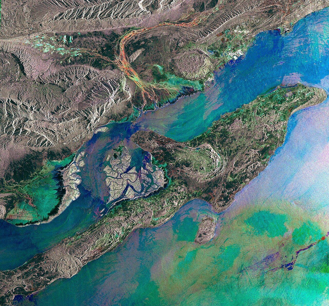

An island on the strait
Seen from above, Qeshm looks like a long fish lying parallel to the mainland. At its western end the channel separating it from the coast narrows to about 2 km. The island is low and dry, with eroded hills of marl and sandstone, salt domes and a scatter of palm groves around wells. Rain is rare and summers are fiercely hot and humid.
Its position has always been its importance. Whoever held Qeshm, with Hormuz and Larak islands nearby, could watch the traffic entering and leaving the Gulf. The Portuguese, who controlled Hormuz in the 16th century, built a fort on Qeshm to guard their water supply; its ruined walls still stand near Qeshm town. In 1622 an Anglo-Persian force attacked the fort as the first step in the campaign that drove the Portuguese from Hormuz. The English navigator William Baffin, known for his Arctic voyages, was killed in the fighting. That campaign is covered on our page on the capture of Hormuz in 1622.
The Hara mangrove forest
Between the north-west of the island and the mainland lies the largest stretch of mangrove forest in the Persian Gulf, known in Persian as jangal-e harâ after the grey mangrove (Avicennia marina) that grows there. The trees stand in salt water and are flooded and drained twice a day by the tides. The Hara Protected Area covers some 85,000 hectares of water, mudflats and forest and is an important stop for migrating birds, including herons, egrets and flamingos. Local boatmen from the village of Tabl take visitors through the channels at high tide.
The geopark
Qeshm’s bare rock exposes its geology unusually well, and in 2006 it became the first member of the Global Geoparks Network in the Middle East. It lost that status in 2013 after reviewers criticised weak protection and infrastructure, and rejoined in 2017 as a UNESCO Global Geopark. The best-known geosites are:
- Stars Valley (دره ستارگان, Dare-ye Setâregân), a maze of pillars and gullies carved by wind and rain. Local legend says it was made by falling stars.
- Chahkooh Canyon, a narrow gorge with smooth, curved walls and rock-cut wells used by local people for water.
- Namakdan Salt Cave (غار نمکدان), cut into a salt dome in the south-west; at about 6.6 km it is counted among the longest salt caves in the world.
We describe these sites in more detail, with visiting tips, in Qeshm Geopark.
Villages and island life
Most people on Qeshm live by fishing, trade and, more recently, tourism. The old village of Laft, on the north coast facing the mangroves, is the most attractive: a cluster of houses with tall windcatchers (bâdgir) on a hill above the harbour, and dozens of old wells cut into the rock. In villages such as Guran and Laft, carpenters still build lenj, the large wooden dhows used for fishing and trade across the Gulf. UNESCO placed the skills of building and sailing lenj on its list of intangible heritage in need of urgent safeguarding in 2011.
At Shibderaz on the south coast, hawksbill turtles come ashore to nest, and the village runs a protected hatchery. In the channel near Hengam Island, off the south coast, boat trips go out to see dolphins. Bandari culture is strong on the island: women in some villages still wear the embroidered face mask called borqe, and the food is built around fish, rice, dates and spices brought by the old trade with India.
Getting there and around
Passenger ferries and speedboats cross from Bandar Abbas to Qeshm town, and car ferries run at the western end, where the channel is narrowest. Qeshm also has an airport with domestic flights. The island is large, so a car or a hired driver is the practical way to see the geosites. The best time to visit is November to March. Check current transport schedules locally and your own government’s travel advice before travelling.
For neighbouring places, see Bandar Abbas, Hormuz Island and Kish Island.
Persian words from this page
| قشم | Qeshm | Qeshm |
| حرا | harâ | grey mangrove |
| لنج | lenj | wooden dhow of the Persian Gulf |
| بادگیر | bâdgir | windcatcher |
| دره ستارگان | Dare-ye Setâregân | Stars Valley |
| غار نمکدان | Ghâr-e Namakdân | Namakdan (salt cellar) Cave |
| تنگه هرمز | Tange-ye Hormoz | Strait of Hormuz |
Sources and further reading
- Encyclopaedia Iranica, article “Qeshm”.
- UNESCO, Global Geoparks Network: Qeshm Island UNESCO Global Geopark.
- UNESCO Intangible Cultural Heritage, “Traditional skills of building and sailing Iranian Lenj boats in the Persian Gulf” (2011).
- Roger Savory, Iran under the Safavids (Cambridge University Press, 1980), on the 1622 campaign.
- Statistical Centre of Iran, 2011 National Population and Housing Census.
Want to learn Persian? Get the free Starter Pack
Get the 14-page printable Starter Pack (all 32 letters, a 7-day reading plan, 100 core words and 20 survival phrases) and a short 5-email course. Free.
More in Cities of Iran
- Tehran: Iran’s Capital
- Mashhad
- Isfahan
- Shiraz
- Tabriz
- Yazd
- Kashan
- Kerman
- Hamadan
- Qom
- Ahvaz
- Rasht
- Kermanshah
- Urmia
- Ardabil
- Zanjan
- Qazvin
- Sanandaj
- Khorramabad
- Bandar Abbas
- Bushehr
- Zahedan
- Birjand
- Gorgan
- Sari
- Semnan
- Arak
- Ilam
- Yasuj
- Shahr-e Kord
- Bojnurd
- Karaj
- Abadan and Khorramshahr
- Kish Island
- Qeshm Island
- Hormuz Island
- Masuleh
- Abyaneh
- Kandovan
- Bam
- Neyshabur (Nishapur)
- Shush (Susa) Today