Bam is an oasis city in Kerman province, on the edge of the Dasht-e Lut desert, famous for Arg-e Bam, often described as the largest mud-brick complex in the world, and for its date palms. On 26 December 2003 an earthquake destroyed most of the city and much of the citadel, killing more than 26,000 people; the city has since been rebuilt, and the citadel is being restored as part of a UNESCO World Heritage Site.
| Persian name | بم (Bam) |
|---|---|
| Province | Kerman |
| Population | 127,396 (2016 census, Statistical Centre of Iran) |
| Elevation | About 1,060 m |
| UNESCO | Bam and its Cultural Landscape, inscribed 2004 (on the danger list 2004–2013) |
| Known for | Arg-e Bam, Mozafati dates, qanats, the 2003 earthquake |
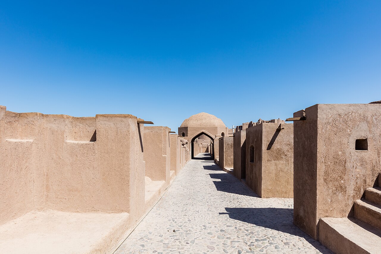

An oasis on the desert road
Bam lies about 190 km south-east of Kerman, on the old route from central Iran to Sistan, Baluchistan and India. Water is the reason it exists. Rain is scarce, about 60 mm a year, but underground channels called qanats bring groundwater from the foothills to the north, and they have watered the palm groves of Bam for many centuries. The qanats and gardens are part of what UNESCO protects, as much as the citadel itself.
The city was known in the Middle Ages for textiles. The 10th-century geographer Ibn Hawqal praised the cotton cloth woven at Bam, which was hard-wearing and sold far afield. Today the economy rests on agriculture, above all the soft, dark Mozafati date, sold across Iran and exported, along with citrus fruit grown in the oasis.
Arg-e Bam
The old walled town on the north-east edge of the city, ارگ بم (Arg-e Bam), covered about 18 hectares, with an outer wall, towers, a bazaar, a mosque, houses, a caravanserai, and a citadel with the governor’s quarters on a rocky hill at its centre. Everything was built of mud brick and rammed earth. Its origins are uncertain: a settlement may go back to the Parthian or Sasanian period, but most of the buildings that stood in 2003 dated from the Safavid era and later.
The town was largely abandoned after the Afghan invasion of 1722 and was used afterwards mainly as a fortress and barracks. In 1794 the last Zand ruler, Lotf Ali Khan, fled to Bam after Kerman fell to Agha Mohammad Khan Qajar, and was handed over to his enemy there. The citadel’s architecture and restoration are covered in detail on our page on Arg-e Bam.
The earthquake of 26 December 2003
At 5:26 in the morning local time, while most people were asleep, an earthquake of magnitude 6.6 (US Geological Survey) struck directly beneath Bam. The rupture was on a fault running under the city itself, so the shaking was extremely violent over a small area. Most houses, built of mud brick or unreinforced brickwork with heavy roofs, collapsed on the people inside.
The number of dead was uncertain for months, and early figures varied widely. The figure usually given now is 26,271 deaths, a revised count from Iran’s Statistical Centre; the United Nations reported that the earthquake killed more than 26,000 people. Around 30,000 people were injured, and most of the survivors were left homeless; a year later, the UN noted, many of the roughly 155,000 survivors in the area were still living in tents and temporary shelters. Most of the city’s buildings were destroyed or damaged beyond repair.
The international response
Rescue teams and aid came from dozens of countries; 44 sent personnel. Among them was the United States, whose relief flights landed in Iran for the first time since the revolution, a moment that briefly eased relations. The UN estimated the cost of reconstruction at between 700 million and 1 billion US dollars.
The citadel after the quake
The earthquake brought down large parts of Arg-e Bam, including much of the citadel on the hill. In 2004 UNESCO inscribed Bam and its Cultural Landscape as a World Heritage Site and immediately placed it on the List of World Heritage in Danger. Iranian specialists worked with teams from Japan, Italy and other countries on stabilising and rebuilding the walls with traditional materials, and in 2013 the site was removed from the danger list. Restoration is still going on.
The disaster also changed building rules in Iran: it showed how many houses ignored the 1989 seismic code. Our history page on major earthquakes in modern Iran places Bam alongside Rudbar and other disasters.
Bam today
The new city is a grid of reconstructed streets, schools and houses built to stricter standards, and its population has grown past its pre-earthquake size. Cemeteries and memorials to the victims stand on the edge of town. The palm groves recovered, and the date harvest in autumn is still the main event of the year.
Bam is also a base for the desert. To the north-west the road leads to Rayen Castle, a smaller mud-brick citadel that survived the earthquake, and beyond Kerman lie the Dasht-e Lut and the Kaluts of Shahdad.
Getting there
Bam has a railway station on the line from Kerman to Zahedan and a small airport, and is about three hours by road from Kerman. The best time to visit is from late autumn to early spring; summers are very hot. Because Bam is on the road towards the south-east of the country, check your own government’s travel advice for the region, and confirm current opening times and tickets for the citadel locally.
For the provincial capital, see Kerman.
Persian words from this page
| بم | Bam | Bam |
| ارگ | arg | citadel |
| زلزله | zelzele | earthquake |
| قنات | qanât | underground water channel |
| خرما | khormâ | date (fruit) |
| نخلستان | nakhlestân | palm grove |
| خشت | khesht | mud brick |
Sources and further reading
- UNESCO World Heritage Centre, Bam and its Cultural Landscape (no. 1208).
- United Nations, press release IHA/976 (December 2004) on the first anniversary of the Bam earthquake.
- US Geological Survey, M 6.6 Southeastern Iran earthquake, 26 December 2003, event summary.
- Encyclopaedia Iranica, article “Bam”.
- Statistical Centre of Iran, 2016 National Population and Housing Census.
Want to learn Persian? Get the free Starter Pack
Get the 14-page printable Starter Pack (all 32 letters, a 7-day reading plan, 100 core words and 20 survival phrases) and a short 5-email course. Free.
More in Cities of Iran
- Tehran: Iran’s Capital
- Mashhad
- Isfahan
- Shiraz
- Tabriz
- Yazd
- Kashan
- Kerman
- Hamadan
- Qom
- Ahvaz
- Rasht
- Kermanshah
- Urmia
- Ardabil
- Zanjan
- Qazvin
- Sanandaj
- Khorramabad
- Bandar Abbas
- Bushehr
- Zahedan
- Birjand
- Gorgan
- Sari
- Semnan
- Arak
- Ilam
- Yasuj
- Shahr-e Kord
- Bojnurd
- Karaj
- Abadan and Khorramshahr
- Kish Island
- Qeshm Island
- Hormuz Island
- Masuleh
- Abyaneh
- Kandovan
- Bam
- Neyshabur (Nishapur)
- Shush (Susa) Today