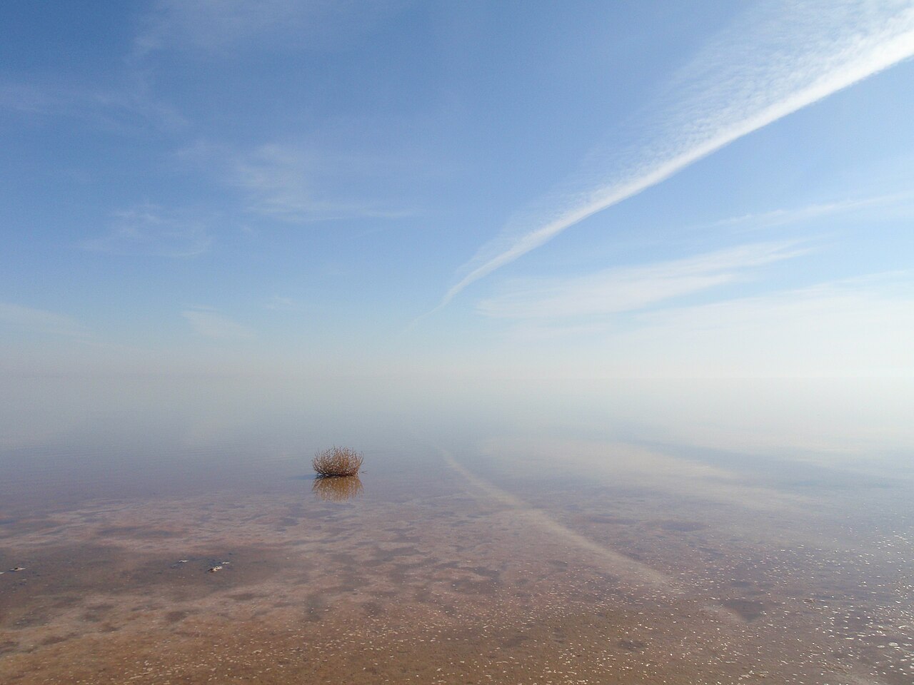
Lake Urmia (دریاچه ارومیه) in north-west Iran was once the largest lake in the Middle East, a hypersaline lake of about 5,000 to 6,000 km² in the late 1990s. Over the following two decades dams, wells and drought drained most of it: by October 2017 official figures put its area at about 1,700 km² and its volume at about one billion cubic metres, and in September 2025 satellite images showed it almost completely dry. Its story is Iran’s best-known environmental crisis.
| Location | Between West and East Azerbaijan provinces, between Urmia and Tabriz |
|---|---|
| Type | Endorheic (no outlet) hypersaline lake |
| Former size | About 140 km long; roughly 5,000 to 6,000 km² in the late 1990s |
| Basin | About 51,900 km², a little over 3% of Iran |
| Protection | National park; UNESCO Biosphere Reserve; Ramsar wetland |
| Key species | Brine shrimp (Artemia urmiana), greater flamingo and other migratory birds |

A lake with no outlet
Lake Urmia lies in a closed basin between the mountains of Kurdistan and the volcanic Sahand massif. Rivers such as the Zarrineh Rud and Simineh Rud bring water in; the only way out is evaporation, which removes something like 0.6 to 1 metre of water a year. The salt stays behind, which is why the lake was always several times saltier than the sea and why only specialised life survives in it: algae, salt-loving bacteria, and the brine shrimp Artemia urmiana, food for flamingos, avocets and shelducks.
About a hundred islands, the largest being Kaboudan and Ashk, once rose from the water and are protected as part of Lake Urmia National Park. For the history of the city on its western shore and the Christian villages around it, see Urmia.
How much water was lost: the figures
Numbers for Lake Urmia vary with the season, the method and who is measuring, so it helps to see several side by side.
- 1995 Peak volume of about 32 billion cubic metres, according to figures reported in Iranian sources.
- 1997–1998 Surface area around 5,000 to 6,000 km² in different estimates.
- 2008 The 1.5 km bridge closing the gap in the causeway across the lake opens, completing a project begun in the 1970s.
- 2012 Iran’s environment chief says the lake is at its lowest level ever recorded.
- 2013 Some estimates put the open water as low as about 500 km². The Urmia Lake Restoration Programme is set up.
- November 2015 Water level reported at 1,270.04 m above sea level, 40 cm lower than a year before.
- 20 October 2017 Restoration headquarters report a level of 1,270.25 m, an area of 1,698.64 km² and a volume of 1.01 billion m³: about 4.5 m below the long-term average level, and some 2,800 km² smaller than the long-term average area.
- Spring 2019 After heavy rains and releases from dams, the level rises by about 118 cm to 1,271.19 m.
- Early 2020s Drought returns and the lake shrinks again.
- September 2025 NASA satellite images show the lake almost completely dried up.
- Early 2026 After an exceptionally wet winter and releases of surplus water from dams, the level is reported at its highest in five years.
Put simply: by the late 2010s the lake had lost most of its area and, by some calculations, more than nine-tenths of its water. One widely quoted estimate is that by late 2017 it was about a tenth of its former size, holding around one-sixtieth of its 1998 volume.
Why it dried
Scientists agree that several causes worked together, though they weigh them differently.
- Irrigation. Farmland in the basin expanded greatly from the 1980s, much of it growing thirsty crops such as apples and sugar beet. Agriculture uses the great majority of the water.
- Dams. Dozens of dams were built on the rivers feeding the lake, holding back water that once reached it.
- Groundwater pumping. Tens of thousands of wells, many unlicensed, lowered the water table and cut the flow of springs and rivers.
- Drought and heat. Below-average rainfall in several periods since the late 1990s, and higher temperatures, cut inflow and raised evaporation.
- The causeway. The embankment across the middle restricted circulation between the two halves of the lake, and the northern half became even saltier.
What the shrinking means
As the shoreline retreated, tens of kilometres of salt flats were exposed. Wind can lift salt and dust from them and carry it over farmland and towns, and people in Urmia, Tabriz and the villages around the lake fear for their health and their fields. Rising salinity hit the brine shrimp and the birds that feed on them. The lake’s decline also became a political issue: environmental protests in Tabriz and Urmia in 2011 were among the largest of their kind in Iran.
Restoration attempts
The Urmia Lake Restoration Programme, set up in 2013, aimed to raise the lake back to an “ecological level” by cutting farm water use, releasing water from dams, dredging channels and transferring water from the Zab river in the south-west of the basin. President Hassan Rouhani approved major funding in 2014, Iran’s Department of Environment and the UN Development Programme prepared a joint plan the same year, and from 2016 the FAO ran a Japanese-funded project on sustainable water use in the basin.
The results show how hard the problem is. In wet years such as 2019 and early 2026 the lake rose quickly; in dry years it fell back. Most experts conclude that lasting recovery depends less on engineering than on using much less water for irrigation across the basin.
Visiting the lake
The causeway on the Urmia to Tabriz road gives the easiest view, across water or salt depending on the year. At times the lake turns pink or red, a colour produced by salt-loving algae and bacteria when salinity is high. Beaches on the western shore have been used for mud and salt-water bathing. Walking on the salt flats is possible near the shore, but the crust can hide soft mud: keep to firm ground, and do not drive onto it. Check local conditions, and follow your own government’s travel advice for Iran.
For Iran’s other great salt landscapes see Maranjab and Varzaneh; for the country’s water geography as a whole, Geography of Iran.
Persian words from this page
| دریاچه | daryâche | lake |
| شور | shur | salty |
| خشکسالی | khoshksâli | drought |
| سد | sadd | dam |
| چاه | châh | well |
| فلامینگو | flâmingo | flamingo |
| احیا | ehyâ | revival, restoration |
Sources and further reading
- Encyclopaedia Iranica, “Urmia, Lake” (Eckart Ehlers).
- Urmia Lake Restoration Programme (Setad-e Ehya-ye Daryache-ye Orumiyeh), level, area and volume bulletins, 2015 to 2019, as reported in the Persian press.
- UNEP Global Environmental Alert Service, “The drying of Iran’s Lake Urmia and its environmental consequences”, February 2012.
- NASA Earth Observatory, satellite images of Lake Urmia, 2013 to 2025.
- FAO, “An Integrated Programme for Sustainable Water Resources Management in the Lake Urmia Basin” (from 2016).
Want to learn Persian? Get the free Starter Pack
Get the 14-page printable Starter Pack (all 32 letters, a 7-day reading plan, 100 core words and 20 survival phrases) and a short 5-email course. Free.
More in Top Places to Visit in Iran
- Naqsh-e Jahan Square
- Shah (Imam) Mosque, Isfahan
- Sheikh Lotfollah Mosque
- Ali Qapu Palace
- Jameh Mosque of Isfahan
- Si-o-se Pol and Khaju Bridge
- Vank Cathedral
- Hasht Behesht Palace
- Naqsh-e Rostam
- Eram Garden, Shiraz
- Nasir al-Molk (Pink) Mosque
- Tomb of Hafez (Hafezieh)
- Tomb of Saadi (Saadieh)
- Shah Cheragh Shrine
- Arg of Karim Khan
- Fin Garden, Kashan
- Historic Houses of Kashan
- Jameh Mosque of Yazd
- Yazd Fire Temple and Towers of Silence
- Dowlatabad Garden and Windcatcher
- Amir Chakhmaq Complex
- Golestan Palace
- National Museum of Iran
- Treasury of National Jewels
- Tehran Grand Bazaar
- Milad Tower
- Imam Reza Shrine, Mashhad
- Tomb of Ferdowsi, Tus
- Tomb of Omar Khayyam, Neyshabur
- Tomb of Avicenna, Hamadan
- Ganjnameh Inscriptions, Hamadan
- Behistun (Bisotun): Visiting the Site
- Taq-e Bostan: Visiting the Site
- Tabriz Historic Bazaar
- Takht-e Soleyman
- Armenian Monastic Ensembles of Iran
- Sheikh Safi al-Din Shrine, Ardabil
- Dome of Soltaniyeh
- Alamut Castle
- Falak-ol-Aflak Castle
- Shushtar Historical Hydraulic System
- Chogha Zanbil: Visiting the Ziggurat
- Susa Archaeological Site
- Arg-e Bam
- Ganjali Khan Complex, Kerman
- Shazdeh Garden, Mahan
- Rayen Castle
- Dasht-e Lut (Lut Desert)
- Maranjab Desert and Caravanserai
- Varzaneh Desert
- Mount Damavand
- Hyrcanian Forests
- Lake Urmia
- Badab-e Surt Springs
- Ali Sadr Cave
- The Kaluts of Shahdad
- Qeshm Geopark
- Hormuz Island Colours
- Visiting Persepolis: A Day Trip from Shiraz
- Visiting Pasargadae
- Persian Caravanserais
- The Qanat of Gonabad
- Meymand Village
- Sasanian Sites of Fars: Firuzabad, Bishapur and Sarvestan
- Gonbad-e Qabus: Visiting the Tower
- Zayandeh Rud and Isfahan’s Bridges
- Tochal and Darband: Hiking Above Tehran
- Mount Sabalan
- Skiing in Iran: Dizin and Shemshak
- Golestan National Park