The Zayandeh Rud (زایندهرود, “the life-giving river”) is the largest river of the central Iranian plateau and the reason Isfahan exists. It rises in the Zagros mountains, flows east through the city under a chain of historic bridges, and ends in the Gavkhouni salt marsh. Since the early 2000s it has often been dry through Isfahan for months or years at a time, because so much of its water is taken upstream.
| Source | Zard Kuh range of the Zagros, Chaharmahal and Bakhtiari province |
|---|---|
| Length | About 300 to 400 km, depending on the source |
| End | Gavkhouni wetland, a salt marsh south-east of Isfahan |
| Main dam | Zayandeh Rud (Chadegan) dam, completed in the early 1970s |
| Historic bridges in Isfahan | Marnan, Si-o-se Pol, Joui, Khaju, Shahrestan (west to east), plus many modern crossings |
The two most famous bridges, Si-o-se Pol and the Khaju Bridge, have their own page: Si-o-se Pol and Khaju Bridge. This page follows the river itself, the other old bridges, and the water problems that now shape every visit.

A river in the desert
Most rivers of the Iranian plateau are seasonal streams that vanish into the sand. The Zayandeh Rud was different: fed by snow on the high Zagros, it used to flow all year. Along its banks a strip of farmland and villages grew up, and at the point where it crosses the plain the city of Isfahan developed. Prehistoric settlements have been found along its course, and by the Sasanian period there was a town here with a bridge.
The river never reached the sea. East of Isfahan it spread out and drained into the Gavkhouni (گاوخونی), a shallow, salty basin that fills and dries with the seasons. It is a protected wetland important for migrating birds, and it has suffered badly as the flow reaching it has fallen.
Sharing the water
For centuries Isfahan’s farmers and gardens drew water from the river through a network of channels called mâdi (مادی), which branched off upstream and ran through the city’s quarters and fields. The shares of each district and village were written down in a famous distribution document, the tumâr, which tradition attributes to the Safavid scholar Sheikh Baha’i; historians debate how much of it is really his.
The Safavids also looked for more water. Shah Abbas I is reported to have begun cutting through the mountains at Kuhrang to divert headwaters of the Karun into the Zayandeh Rud, a project that was not completed in his time. In the 20th century engineers finally did it: tunnels at Kuhrang, the first opened in the 1950s, now carry water from the Karun basin across the watershed, and the large dam at Chadegan stores the river’s flow above Isfahan.
The bridges, west to east
Marnan Bridge
At the western end of the historic city, the Marnan Bridge (پل مارنان) has a Safavid superstructure on foundations that may be much older. It is less visited than the Safavid showpieces downstream and gives a quieter view of the river.
Si-o-se Pol
Built around 1600 for Shah Abbas I to carry the royal Chahar Bagh avenue across the river; see its own page.
Joui Bridge
Between Si-o-se Pol and Khaju is the small Joui Bridge (پل جویی), built in 1655 under Shah Abbas II. About 147 metres long, with 21 arches, it was a private crossing that linked royal gardens on the two banks, and its name comes from the water channel (ju) that ran along it to water them.
Khaju Bridge
A bridge and weir of the 1650s, with a pavilion for the shah in the middle; also covered on the Si-o-se Pol and Khaju page.
Shahrestan Bridge
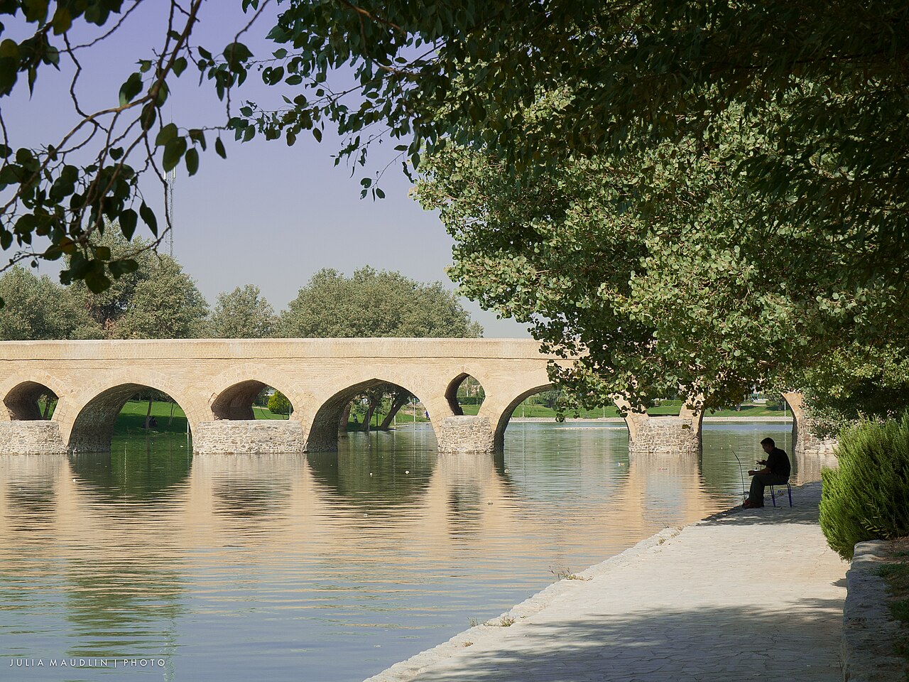
Some way downstream, on the eastern edge of the city, is the oldest of them all. The Shahrestan Bridge (پل شهرستان) stands on Sasanian foundations, with an upper structure rebuilt in the Buyid and Seljuk periods. It is about 108 metres long, with 13 large pointed arches and smaller openings between them, and its plain, weathered stonework feels very different from the elegant Safavid bridges upstream. It sits in a quieter area, and is worth the short trip for anyone interested in how Isfahan looked before the Safavids.
When the river runs dry
From the late 1990s onwards drought, population growth, irrigation, heavy industry and the transfer of water to other provinces combined to take more water from the Zayandeh Rud than it could supply. In the early 2010s the river through Isfahan dried out completely for long periods. The authorities now release water for limited periods, often around Nowruz or for farming, and when they do, crowds gather on the banks and the bridges.
Water is a sensitive public issue. Farmers in eastern Isfahan, whose fields depend on the river, have protested repeatedly; a large protest in the dry riverbed in November 2021 drew national attention. Plans to bring more water from other basins remain controversial between provinces. For visitors this means that the city’s riverside, one of the great urban landscapes of Iran, may be a green park beside flowing water or a wide bed of dry sand, depending on the year.
Visiting the river
- A walk along the north bank from Marnan to Khaju takes an afternoon; the parks along the river are where Isfahanis picnic, walk and meet in the evening.
- Shahrestan is farther east; take a taxi.
- Ask locally or check the news to find out whether the river is flowing during your visit.
- For the city as a whole, see Isfahan, and for its design, Isfahan: “Half the World”.
- Follow your own government’s current travel advice for Iran.
Persian words from this page
| زایندهرود | Zâyande Rud | “the life-giving river” |
| پل | pol | bridge |
| مادی | mâdi | irrigation channel (Isfahan) |
| جوی | ju(y) | stream, water channel |
| سد | sad | dam |
| تالاب | tâlâb | wetland, marsh |
| خشکسالی | khoshksâli | drought |
Sources and further reading
- Encyclopaedia Iranica, “Bridges”.
- Wilfrid Blunt, Isfahan: Pearl of Persia (London, 1966).
- Sussan Babaie, Isfahan and Its Palaces: Statecraft, Shi’ism and the Architecture of Conviviality in Early Modern Iran (Edinburgh University Press, 2008).
- Ramsar Convention, site information for the Gavkhouni wetland.
Want to learn Persian? Get the free Starter Pack
Get the 14-page printable Starter Pack (all 32 letters, a 7-day reading plan, 100 core words and 20 survival phrases) and a short 5-email course. Free.
More in Top Places to Visit in Iran
- Naqsh-e Jahan Square
- Shah (Imam) Mosque, Isfahan
- Sheikh Lotfollah Mosque
- Ali Qapu Palace
- Jameh Mosque of Isfahan
- Si-o-se Pol and Khaju Bridge
- Vank Cathedral
- Hasht Behesht Palace
- Naqsh-e Rostam
- Eram Garden, Shiraz
- Nasir al-Molk (Pink) Mosque
- Tomb of Hafez (Hafezieh)
- Tomb of Saadi (Saadieh)
- Shah Cheragh Shrine
- Arg of Karim Khan
- Fin Garden, Kashan
- Historic Houses of Kashan
- Jameh Mosque of Yazd
- Yazd Fire Temple and Towers of Silence
- Dowlatabad Garden and Windcatcher
- Amir Chakhmaq Complex
- Golestan Palace
- National Museum of Iran
- Treasury of National Jewels
- Tehran Grand Bazaar
- Milad Tower
- Imam Reza Shrine, Mashhad
- Tomb of Ferdowsi, Tus
- Tomb of Omar Khayyam, Neyshabur
- Tomb of Avicenna, Hamadan
- Ganjnameh Inscriptions, Hamadan
- Behistun (Bisotun): Visiting the Site
- Taq-e Bostan: Visiting the Site
- Tabriz Historic Bazaar
- Takht-e Soleyman
- Armenian Monastic Ensembles of Iran
- Sheikh Safi al-Din Shrine, Ardabil
- Dome of Soltaniyeh
- Alamut Castle
- Falak-ol-Aflak Castle
- Shushtar Historical Hydraulic System
- Chogha Zanbil: Visiting the Ziggurat
- Susa Archaeological Site
- Arg-e Bam
- Ganjali Khan Complex, Kerman
- Shazdeh Garden, Mahan
- Rayen Castle
- Dasht-e Lut (Lut Desert)
- Maranjab Desert and Caravanserai
- Varzaneh Desert
- Mount Damavand
- Hyrcanian Forests
- Lake Urmia
- Badab-e Surt Springs
- Ali Sadr Cave
- The Kaluts of Shahdad
- Qeshm Geopark
- Hormuz Island Colours
- Visiting Persepolis: A Day Trip from Shiraz
- Visiting Pasargadae
- Persian Caravanserais
- The Qanat of Gonabad
- Meymand Village
- Sasanian Sites of Fars: Firuzabad, Bishapur and Sarvestan
- Gonbad-e Qabus: Visiting the Tower
- Zayandeh Rud and Isfahan’s Bridges
- Tochal and Darband: Hiking Above Tehran
- Mount Sabalan
- Skiing in Iran: Dizin and Shemshak
- Golestan National Park